The country is laden with the Himalayan Mountains and hills in the north and flat plains in the south ranging from the highest point on earth (8,848 m) down to 70 m within only 210 km.
These in turn have resulted in abysmal living conditions – a recent report by Nepal Government indicated that the earthquake and its aftermath have pushed an estimated one million people below poverty line which is below $1.25 income per day.
Nepal
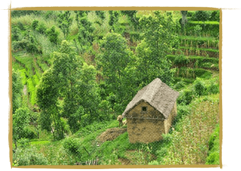
Nepal (officially the Federal Democratic Republic of Nepal) is located in South Asia, sandwiched between China and India. It is the home to Mt. Everest, the birthplace of Lord Buddha and is one of the few countries in the world never to have been colonized. The country is laden with the Himalayan Mountains and hills in the north and flat plains in the south. The largest and the capital city is Kathmandu, which is situated in the central region of the country. Tourism and agriculture are the major sources of revenue and livelihood for a vast majority of the Nepalese people, most of them are based in rural areas.
Despite its stunning beauty and a proud history, Nepal has long suffered from major political upheavals, clearly reflected from its poor socioeconomic performance (HDI ranking 145th in 2014). A decade-long civil war, centralized government and polarization of wealth and power have severely hindered the growth of the country. Besides that, the 7.9 magnitude earthquake on April 25, 2015 hit as many as 36 out of 75 districts of Nepal and among them 14 are worst hit where 8,800 people were killed, thousands injured and an estimated one million residents displaced. These in turn have resulted in abysmal living conditions – a recent report by Nepal Government indicated that earthquake and its aftermath have pushed an estimated one million people below poverty line which is below $1.25 income per day.
The 2015 Nepal Earthquake took a heavy toll on the national education and health infrastructure. Then in the same year, the unofficial Indian blockade for the supply of fuel, food, gas and medicines right after the earthquake worsened the scenario by affecting daily operations of schools, hospitals, business houses, government offices and transportation. This halted the pace of development of Nepal and created a host of problems for all Nepalis. But over the years Nepal overcame and was moving forward.
In 2020, as it was the same for all the countries worldwide, Nepal enforced the countrywide lockdown to combat and prevent the spread of the deadly Covid-19. As a result, everything except the emergency services was closed. There was no transportation. Businesses of all sizes and types either shutdown temporarily or permanently, creating mass unemployment or partial employment which isn’t good either. Some implemented the work from home mode but it wasn’t possible for the majority of people and businesses. Everyone had to stay indoors. This put the serious setback to everyone else. It pushed many people into poverty and everyone took a huge financial hit. The people of Gorkha (the project area of Sambhav Nepal) were affected severely. Then, things started to get back to normal with the easing of lockdown and gradual opening of all services and business. But, in 2021, due to the spread of new and deadlier variants of Covid-19, the nationwide lockdown had to be enforced again, repeating the events from 2020. We are now in the lockdown and this has severely affected everyone, especially those from weaker economic backgrounds.
About Gorkha
Situated on the North-central part of Nepal, the Gorkha district hosts a very significant historical and political identity. The district capital, Gorkha Bazaar, is about 140 km west of Kathmandu at an altitude of 1,135 m. Gorkha’s centerpiece is the magnificent Gorkha Durbar with a fort, a palace and a temple with excellent views of the surrounding valleys and the Manaslu range.
The history of modern Nepal started some 200 years ago from the Gorkha district, when King Prithivi Narayan Shah conquered 22 small kingdoms and created Nepal as we know today. His legacy passed on to his successors who kept foreign occupation at bay. The formidable courage and bravery earned the Gorkha soldiers great respect among the East India Company (British regime in India), who knew the Nepalese soldiers as the Gurkhas.
After a standstill in a battle in Nalapani (eastern Nepal), a treaty was signed between Nepal and the Great Britain that allowed the Gorkha soldiers to enrol in a special regiment called the Gurkha Rifles in the British Army. The Gurkhas have fought bravely in many international battles, most notably in the two World Wars, the Falkland War and the Gulf Wars.
Gorkha is also an alternate starting point for a few trekking routes in the region. Gorkha-Trisuli is an easy three-day walk along unspoilt Nepali countryside. One can also walk a long day’s walk to Beshisahar, which is the usual starting point for Annapurna and Manang area treks. One can also walk through Beshisahar area to Pokhara in four days.
Sadly, Gorkha district was the epicenter of the 7.9 magnitude earthquake of April 25th 2015, destroying almost 90% of the private homes and more than 95% of the schools. The continuous aftershocks have damaged the remaining, hampering emergency rescue teams.
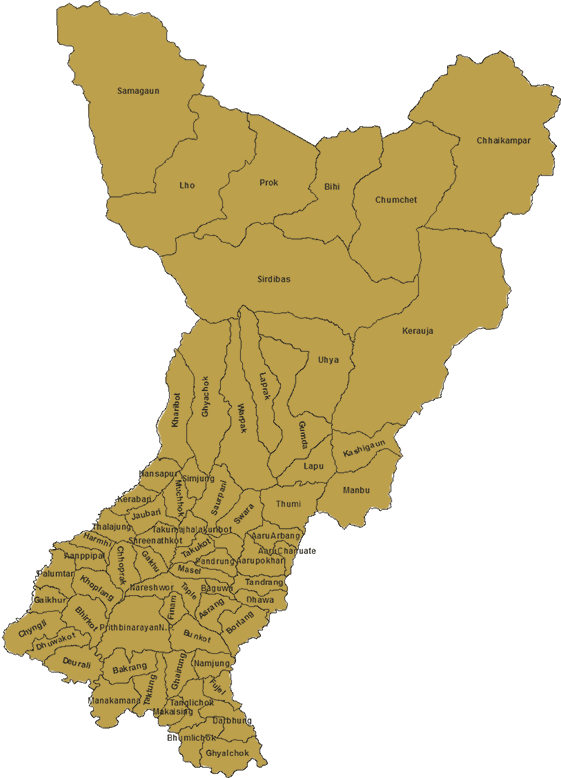
Our Project Area
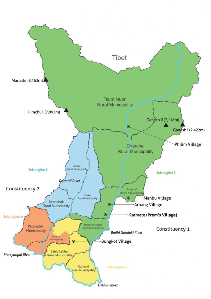
Our project area is the entire Gorkha district which is divided into two parliamentary constituencies: 1 and 2. They are further divided into sub-regions which you can see in the map below. Each sub-region is highlighted for easy identification.
In Constituency 1, the yellow is Sub-region A and the green is Sub-region B. In Constituency 2, the orange is Sub-region A and the blue is Sub-region B.
In these four sub-regions, our main focus is always on Sub-region B of Constituency 1. It includes Tsum Nubri, Dharche, Arughat and Bhimsen Rural Municipalities.
Please see below to know why we are primarily focused on sub-region B of Constituency 1:
Sub-region B is more remote and lies in higher altitudes than any other areas of Gorkha. Its northernmost rural municipality Tsum Nubri shares the borders with Tibet. Half of the region is inaccessible.
There are needier and poorer people in this sub-region, therefore requires more help in uplifting their economic and health situations.
The sub-region has more population than any other areas of Gorkha. Helping this area means helping more people and meeting our goals earlier.
Usually, our projects are limited to Sub-region B of Constituency 1 for the reasons mentioned above. In other words, the projects start and end here, without covering other regions. But, if funding is available and our projects can be done in other locations, we then cover Sub-region A of Constituency 1, which includes Gorkha Municipality, Gandaki Rural Municipality and Sahid Lakhan Rural Municipality. And, only if there is additional funding or if we have large donors who, we expand our projects to Constituency 2. In short, our priority starts from Sub-region B of Constituency 1, then to Sub-region A and finally to Constituency 2.
Sambhav Nepal has been meticulously working to ameliorate the situations in Gorkha district for a long time. We run projects to benefit as many people as we can (depending on the funding available) and make a difference in the lives of many people who hail from weaker economic backgrounds, and we will continue to do so for many years in our project area.
 Swiss Version